
Aerial Photography & Video in Riverside
Real Estate Media for Riverside & the Inland Empire — Booked Online, Delivered Next Day
- Next-Day Delivery
- FAA Part 107 Certificated Drone Pilot
- Business & Drone Insured
- Simple Online Ordering
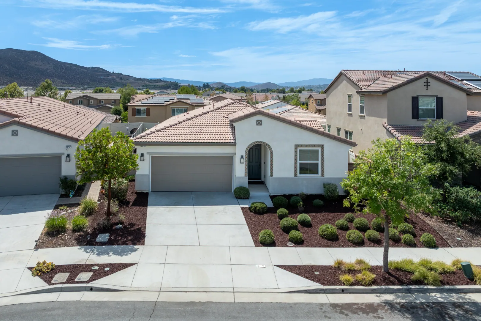
Drone Photography Captures Riverside Listings From Above
Book drone media when the best thing about a property can't be seen from the ground, like the lot, the land, the view, or what's nearby. Add drone video when the approach and setting tell the story better in motion. Drone photography may be less useful when the aerial view mainly shows rooftops and neighboring properties rather than features that distinguish the listing.
Here's the simple test. Stand at the curb and ask yourself what a buyer can't see from there. If the answer is a big part of the price, you may need a shot from above. If the answer is not much, your ground photos may be enough.
Drone photos tend to earn their place when a listing has:
- A large lot, acreage, or a usable yard that a wide-angle ground shot can't fit in one frame.
- A pool, outdoor kitchen, RV parking, or a detached unit that buyers want to see in relation to the house.
- A view of hills, open space, or a skyline that sells the home more than the kitchen does.
- A setting that matters, like being close to a park, a trail, a golf course, or open land.
- Land, lots, or a property where the boundary and layout are the main questions buyers ask.
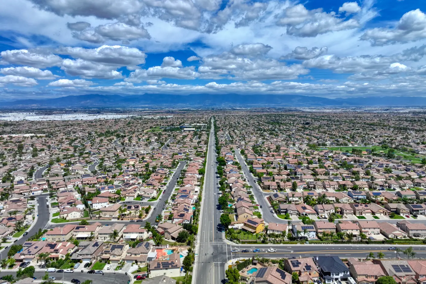
Across Riverside and the Inland Empire, you may list everything from tight tract homes to properties with real land around them. That range is why this isn't an automatic add-on. It's a call you make per listing.
Photos or video? Photos usually do the heavy lifting on the MLS and portal pages. A strong drone photo can be your lead image or a key shot in the first few, so buyers get the full picture before they scroll. Video earns its spot when movement explains the property better than a still can. A slow pull-back from the front door that shows the lot, the street, and the hills behind it tells a buyer in seconds what three photos only hint at. Drone video also works well as footage combined with inside property video or a vertical walkthrough reel for social media.
If you're not sure, ask yourself one question. Does the setting need context or just a clear view? A clear view may just call for ground photos. Context, like how the home sits on the street or how close it is to open space, may call for video.
Now the honest part. Sometimes a drone won't help you, and we'd rather tell you that up front.
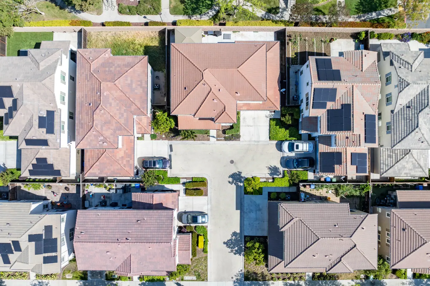
- A small lot packed between neighbors, where the top-down view mostly shows rooftops and fences.
- A home with a tired roof or yard you'd rather not put front and center.
- A listing where your budget is better spent on interior photos, a 3D tour, or a floor plan.
Location can also limit what's possible. Some areas sit in controlled airspace or near places where flights need extra approval or aren't allowed at all. That's one reason it matters who's flying. Our pilot is FAA Part 107 certificated, and we're business and drone insured, so we can check whether an address can be flown and what you can expect to get.
Checking a Drone Operator's Certification and Insurance
Before hiring a drone operator for a real estate listing, confirm that the pilot holds an FAA Part 107 remote pilot certificate and carries insurance covering drone operations.
Commercial drone photography requires an appropriately certificated pilot. Part 107 certification establishes that the pilot has met the FAA's applicable knowledge and certification requirements.
Insurance is another consideration because drone operations involve potential risks to people and property. Business liability and drone liability coverage may help address covered incidents, depending on the policy terms and circumstances.
Verifying certification and insurance gives agents and brokers important information when selecting a drone photography provider.
Here's what to ask before you book:
- Can I see your Part 107 remote pilot certificate? Check that the name on it matches the person who'll be flying.
- Is your business insured, and does the policy cover drone flights? Some general business policies leave aircraft out, so ask about the drone itself.
- Who's flying at the property? The certificated pilot should be the one at the controls, not a helper.
- Can you check this address before the shoot? A real operator will tell you up front if the location limits what may be possible.
Watch for red flags. A friend who flies for fun. An offer to shoot it cheap on the side. An operator who gets vague when you ask about coverage or can't show a certificate. Ground photos from that person might be fine. Aerials over a client's property are a different job.
Your brokerage, a property manager, or an HOA may also ask for proof that your vendors are covered. It's a lot easier when the operator you hired already checks every box.
Every drone photo and video shoot from TinySeed Real Estate Media is flown by an FAA Part 107 certificated pilot, and the business carries business and drone liability insurance. That's the credibility your listing needs, without slowing you down. You can book online in minutes and get your standard media the next day, whether the home is in Riverside or elsewhere in the Inland Empire.
For a broader overview of our photography services, explore TinySeed's real estate photography services.
Flight Authorization Near Riverside Municipal Airport and March Air Reserve Base
If your listing sits near Riverside Municipal Airport or March Air Reserve Base, a drone may not be able to just go up and fly. Both have controlled airspace around them. A pilot needs FAA approval before flying there. The good news is that many homes near these spots can still get great aerials. Checking the property's location before scheduling aerial photography can help identify potential flight restrictions or authorization requirements.
Here's why it matters. Planes and helicopters take off, land, and circle near airports and air bases at low heights. That's the same space a drone uses to shoot a house. The FAA keeps drones and aircraft apart by making pilots ask first. That's the airspace training from the Part 107 test at work.
Approval doesn't work the same way for every address. Some requests come back fast. Others take longer, come with a lower height limit, or get turned down. A military base can bring extra limits that a city airport doesn't. Short-term flight restrictions can also pop up for events or special activity, even over a spot that was fine last month.
What does that mean for your shot? Most of the time it means a height cap, not a lost listing. A lower flight may still show the lot, the pool, the yard, and how the home sits on the street. That's what most buyers want to see. A high, wide view of the whole area may not be possible close to the runway or the base. If that big view is the main reason you want aerials, ask about it before you book.
Picture a home a few streets from the airport with a big backyard and a detached garage. You book the shoot for the day before your listing goes live. Then you find out the flight needs approval that won't clear in time. Now your photos launch without the one shot that shows off the lot. A few extra days of lead time may have fixed that.
Here's how to keep your launch on schedule when a listing is near either airfield:
- Don't plan aerials for the last day before your listing goes live.
- Book your ground photos so they don't depend on the drone. Your listing can go live with interior and front shots while aerials are added.
- Tell your seller up front that the flight may have a height limit, so nobody is surprised by the final images.
- Ask what shots are realistic for that address before you promise drone video in your listing pitch.
This is where it pays to hire a certificated pilot. Someone flying without Part 107 training may not know the airspace is controlled at all. That puts your seller, your brokerage, and your listing at risk. Our FAA Part 107 certificated pilot knows to check this before the flight, and we're business and drone insured.
Drone Video Shows Riverside Properties in Motion
Most listings only need drone photos. Book drone video too when you'll market the home beyond the MLS, like on social, in a property video, or in your listing pitch. If you're putting real effort into a launch, get both in one visit. It's simpler and it keeps your timeline tight.
The easiest way to decide is to think about where each file will end up.
- Drone photos usually go on the MLS, Zillow, your flyers, and your listing presentation. Still photographs may be especially useful when agents want to highlight the property's lot, exterior features, and surrounding setting in a listing gallery.
- Drone video might go on social posts, your website, and inside a standard property video or premium property video. Video can provide additional context through movement, particularly when showing the property's surroundings or the relationship between different outdoor features.
- Both may make sense when you want one set of aerials to work in every place you promote the home.
That's also why video alone is rarely the right call. Even a great aerial clip can't be your lead MLS image. You'll usually still want stills.
Cost follows the work. Across the industry, a few things push the price of aerial media up or down:
- Format. Video may take more flight time and may take more editing than stills, so it usually costs more than photos alone.
- Property size. Acreage or a long lot can take more passes and angles to cover.
- Location. An address that needs flight approval may need more planning time.
- Trips. One visit for photos and video is often more efficient than two separate flights.
- Packaging. Aerials packaged with a ground shoot may be priced differently than a drone-only visit.
Before you book with anyone, ask what you're really getting. How many final edited photos? Is the drone video a short clip, raw footage, or edited with music? Can the drone footage be cut into a property video or a reel later? Clear answers keep you from paying for something you won't use, or missing the one shot you needed.
Here's an example case. You list a home with a big backyard, a pool, and open hills behind it. You book drone photos only. A week later, you want a reel for social and a video for your seller. Now you need a second flight, a second weather check, and maybe a second airspace check. Booking drone video with the photos would have covered it in one trip.
Drone photographs may be sufficient when the main goal is to showcase the property and its surroundings in a listing gallery. Drone photography and video together may be useful when agents also want moving footage for broader listing marketing. Both services can be ordered alongside other TinySeed listing media, although appointment requirements may vary.
Whichever you pick, it's flown by our FAA Part 107 certificated pilot, and we're business and drone insured. You'll get your standard media the next day, so you can launch when you're ready.
Call now · (951) 618-2462
How Aerial Media Pricing Is Typically Structured
Most real estate drone work is sold in one of three ways: as an add-on to a ground shoot, as a drone-only visit, or as part of a bundled package. The model shapes what you pay as much as the shots do. Once you know which model a quote uses, it's much easier to compare two offers fairly.
- Add-on pricing. Aerials ride along with a photo or video shoot that's already booked. The provider is already on site, which may reduce the need for a separate appointment.
- Drone-only visits. These are a standalone trip just for aerials. Expect the setup, travel, and airspace check to be built into that one price.
- Bundled packages. These group drone media with listing photos, video, a 3D tour, or floor plans under one price, usually in tiers like basic, standard, and premium.
- Size tiers. Some providers price by home square footage or lot size. Make sure you know which number they use, because a small house on a big lot can land in different tiers.
A quote is more than the headline number. Look at what's counted. Drone photos may be priced by a set number of final edited images. Video may be priced by length and editing level, from a short clip to a fully edited piece with music. Two quotes with the same price can deliver very different amounts of usable media.
Usage rights matter too. Ask whether you can use the files on the MLS, portals, social, and your own marketing, and for how long. Some providers limit use to one listing. That's fine for most agents, but it matters if you want to reuse an aerial of a neighborhood in future listing pitches.
Watch for line items that may show up later. Travel fees can apply to properties far from the provider's base. Weather and reshoot policies may vary a lot by provider. Some providers reschedule a windy day at no charge. Others bill a trip fee if they've already driven out. Rush delivery is sometimes priced on top of the standard rate, so ask what the normal turnaround already includes.
A simple way to budget is to match the pricing model to the listing. If you're already booking ground photos, adding aerials may be the efficient route. If the land is the whole story, a package with drone photos and video may cover it in one trip. Consider whether aerial photographs or video would contribute useful information about the property that ground-level photography may not show.
At TinySeed Real Estate Media, you can see your options and book drone photography or drone video online in minutes, with media delivered the next day.
Call now · (951) 618-2462
Watch Our Video
See How We Handle Drone Photography & Video in Riverside, CA
Frequently Asked Questions
Can I still get good drone photos if my listing is near March Air Reserve Base?
Yes, many homes near the base can still get great aerials, just with a possible height limit. A lower flight may still capture the lot, the pool, the yard, and how the home sits on the street, which is what most buyers want to see anyway. A high, wide view of the whole area may not be possible that close to the base, so ask about that shot before you book it.
What happens if the weather is bad on my scheduled shoot day?
Wind and rain can push a drone flight to a different day, so ask about the reschedule plan before you book. It's worth confirming this upfront so you know what to expect if your listing date is tight. Settling this ahead of time avoids a surprise call the morning of your shoot.
Can drone video footage be reused in a property video or social reel later?
That depends on how the footage was shot and what you ask for upfront, so it's worth confirming before the flight. If you book drone video along with your photos in one visit, that footage can often be cut into a property video or a vertical walkthrough reel for social. Booking both at once may save you from a second flight, a second weather check, and a second airspace check later.
Ready to Get Started?
Book a Shoot. Call (951) 618-2462 today.